
By: Dr. Athar Osama
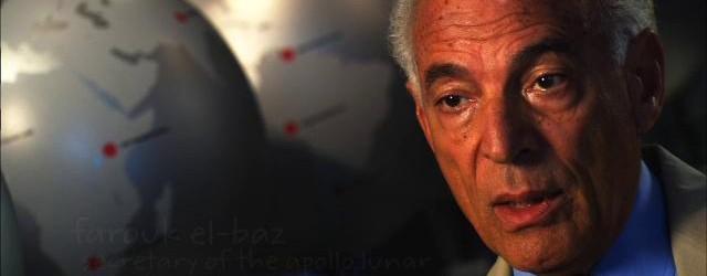
localhost/muslim talked with Dr. Farouk El-Baz – a celebrated Egyptian scientist, former Science Advisor to Egyptian President Anwar Sadat, and currently the Director of Boston University’s Centre for Remote Sensing – about his contribution to Apollo Programme, science and literacy in Egyptian society, and his proposal for a Development Corridor.
Dr. Farouk El-Baz is considered one of the founding fathers of the science of remote sensing – an area that he stumbled across in the late 1960s when he began working on the Apollo Programme as a part of one of over 126 centers and universities across the US that were engaged in that $24 billion initiative. Soon, Dr El-Baz was the Secretary of the Committee that selected Landing Site and later became Chairman of astronaut training in Lunar Visual Observations and Photography. Dr. El-Baz’s work was deemed extremely useful by the Apollo Astronauts and he was fondly nicknamed “the King” among the Apollo Community. His contributions have been widely and popularly acknowledged including one of Star Trek’s spaceships (“El-Baz”) named after him.
This was only the beginning of Dr. El-Baz’s contribution to science and the broader community. After the Apollo 17 in 1972, he focused his attention to the use of remote sensing to the study of deserts – a pursuit deemed so useful for his own native Egypt that he was appointed Science Advisor to President Anwar Sadat in 1978 and remained in that position until Sadat’s death. Mapping in detail the Egyptian Desert – and studying its ecology – El-Baz became convinced of the need for a development infrastructure to populate the area west of Nile River and its Delta as an economic imperatives for Egypt. He proposed the idea in early 1980s and has since struggled to make it happen.
localhost/muslim’s conversation with Dr. Farouk El-Baz focused on his early experiences in Egypt, his move to the US and involvement in the Apollo Programme, and subsequent work on the science of deserts. This interview is being produced below for the benefit of localhost/muslim’s audience.
Muslim Science (MS): Please tell us about the early days. How did you end up at the Apollo Programme at NASA?
Farouk El-Baz (FEB): I was born in 1938 in Egyptian the Nile delta town of Zagazig and did my bachelors degree in chemistry and geology at Ain Shams University in Cairo. After this, I moved to US to do my masters and PhD in geology from Missouri School of Mines and Metallurgy and did part of my research work at MIT during 1962-63. I moved back to Egypt in 1965-66 with an intention to establish a School of Economic Geology. I was appointed to a Higher Institute in Suez and was asked to teach chemistry. Frustrated at not being able to realise my ambition, I left Egypt to return to US in 1967.
This was a high point of US Science as the Apollo Programme was in full swing. I quickly found himself working on Apollo as one of over 126 universities and research centres that were involved in that gigantic scientific enterprise.
MS: So what did you actually do at the Apollo Programme?
FEB: I initially started work on the Apollo Programme as a Supervisor of Lunar Science Planning at Bellcomm Inc. – a Division of AT&T that worked on contract for NASA. During the next six years, I was the Secretary of the Landing Site Selection Committee for the Apollo Lunar Landing Missions. As the name suggests, our initial task was to identify landing sites for the Lunar Vehicle based on a number of characteristics of which most important was safety but also interesting features of nearby to collect useful samples.
We soon realised that the Astronauts that were going to land on the Moon had no idea of what to expect, thus, it was important to train them to manage their mission and data collection on the lunar surface. They were not particularly trained in reading the geographical features of the land or even for identifying interesting landforms. Each Lunar Mission costed a great deal of money and much preparation and it was our duty to get as much information back as possible. In order to do so, it was critical that the Astronauts themselves became active and intelligent participants in this data collection activity rather than mere robots performing what was asked of them to perform.
NASA launched an extensive training programme for Astronauts and I became the Chairman of the Astronaut Training Group and the Principal Investigator of Lunar Visual Observation and Photography. Because of our work, the Apollo Astronauts were much better trained in both expecting what they encountered but also in active observations of phenomenon we, the Mission Planners on the Ground, had not anticipated in the first place.
Famously, while orbiting the Moon for the first time during Apollo 15, Command Module Pilot Alfred Worden said, “After the King’s [Farouk’s nickname] training, I feel like I’ve been here before.”
MS: That’s quite remarkable. Did you believe your work made a scientific contribution to the Apollo missions?
FEB: One aspect of our contribution was to ensure the safety of the Lunar Vehicle. We used high resolution satellite imagery acquired by unmanned spacecraft to identify sites that were safe to land. For example, we had no information on topography of the land and had to develop algorithms to determine the tilt and identify detailed features of the land. This was important because Lunar Vehicles could not land where the tilt was greater than 13 degrees.
Another important aspect of our work was not only train the Astronauts to expect what they were likely to see but also to become intelligent and active participants in the data collection process. I often said to them “anybody can look, but only some can see” and our job was to help them “see” by equipping them with the power tools of observation and a scientific language. A very clear evidence of this approach came about when an Apollo 15 Astronaut noticed a field of a field of dark volcanic cones on the surface of the Moon which was not in the prior knowledge of mission planners. He remarked that these were like the volcanic cinder cones in Arizona that he had seen during this training.
This single observation resulted in selecting the site as the landing area of Apollo mission 17 to study that field of craters on the lunar surface. That observation would not have been possible without a prepared “eye” and mind of a thoroughly trained observer.
MS: As Apollo Programme came to and end, you began your research on the geology and ecology of deserts. How did that come about?
FEB: Apollo was a great experience. It taught the world a lot of things. Above all it taught us about the triumph of the human spirit. Given the right resources, a timeline, and a clear objective, men and women with a variety of skills could come together to perform unbelievable tasks. Incidentally, my work at the Apollo Programme led to my subsequent research on the deserts. After Apollo, I became involved with the Apollo-Soyuz Test Project where my job was again to train the Astronauts. I brought together the best experts from the around the country on every possible geographical feature of earth to talk to Astronauts and answer questions. While these experts had a lot of knowledge on almost every subject, I thought that some of the best experts we had – from US Geological Service (USGS) and elsewhere – were very hesitant answering questions about deserts. It was then that I realized that our knowledge of deserts wasn’t as good as other geological features of our planet like mountains, and plains. That is when I became interested in researching the deserts.
MS: Tell us about your desert research? How did you begin and what did you find?
FEB: The opportunity came about in 1974 when I went to Egypt on the invitation of President Sadat who was very supportive of my aspirations. I established a desert research Programme in collaboration with scientific groups in Egypt and brought in $250K to buy jeeps and equipment. Once this was done we started making our trips to the Egyptian deserts. For example, we began measuring the movement of sand dunes and sought to understand where sand (grains of 0.2 to 2mm) came from. It was common perception at that time that sand grains were rounded by wind action. We found instead that they were a product of water erosion. Sand was created as a result of turbulent flow in the bottom of rivers and then deposited in low areas to settle in the bottom of lakes. When the latter dried up the wind shaped the sand into dunes. This meant that where there was sand, there used to be an area of low topography that collected water. There, was a greater chance of finding water below the surface of the desert. That’s what our science told us. What was difficult to estimate is how deep or how saline the water would be. For that one has to drill an exploration well.
MS: So your theory on how sand dunes were made led to the ability to predict where one might find water under the desert. That sounds like a pretty useful thing to know. Did you find this practically useful as well?
FEB: We have since applied our ideas to a number of places around the world particularly in India and China. We were invited by Chinese Academy of Sciences to look at Taklamakan Desert in China and recommended the locations where drilling could result in groundwater. These recommendations helped the Chinese establish agriculture in that desert. Similarly we advised the Indian Government on Rajasthan Desert and the Egyptian Government. It took 13 years to convince the latter to drill one well in the south-western desert. Water was found and today there are more than 1000 wells that can water 250,000 acres of new agricultural land.
MS: This became very close to your heart as you began your quest to create a Desert Development Corridor in Egypt. Tell us about that?
FEB: I became President Sadat’s Science Advisor in 1978 and remained in that position until his death in 1981. As someone with deep knowledge of the Egyptian Desert, I had become acutely aware of some of the key issues surrounding these. Egypt has 5.5 million acres of fertile land and 10.5 million acres of desert with about 10% of it good for agriculture. Historically, the Egyptian Civilisation has concentrated around the Nile Valley from the border of Sudan to Cairo and from there parallel to the Nile Delta until the coastline of the Mediterranean Sea.
Over the centuries there has been migration of people towards this region and very few will live in the harsh conditions of the desert (see chart, right, of Egyptian population density). With over 80 million in Egypt today (expected to grow to 140 million in 2050), this area is becoming vastly over-populated as agricultural land shrinks due to urban encroachment at the rate of about 30,000 acres a year. If unchecked, this means that Egypt will lose all its fertile land in 183 years. Furthermore, over population is causing suffocation of the Egyptian towns.
This is becoming a matter of life and death for the Egyptian Civilisation and something needs to be done about it.
MS: So what do you propose through the concept of the Desert Development Corridor?
FEB: I have proposed a mega-infrastructure development project to fully link the country with a world class superhighway from the North to the South and with population centres through a series of 12 arteries running from the towns in the East to the main Corridor in the West. This will have a number of very beneficial features.
First, it will establish the critical transportation infrastructure necessary to build smaller cities and communities west of the Nile Valley and Delta that are not isolated but linked with the rest of the country through an important lifeline. This will open up new patches of lands for people to live on.
Second, the Corridor will establish a direct link for transportation and trade from the Mediterranean all the way down to Sudan. Hopefully, someday it would extend all the way down to the edge of Africa at Cape Town.
Third, this would open space in Egypt and unleash an era of opportunities and the creativity of the Egyptian people.
The idea of the Desert Development Corridor is based on sound principles of development planning developed and vetted over a number of years and an intimate knowledge of Egypt’s deserts. Similar transportation corridors have been developed elsewhere, such as in the United States the railroad from east to west then the Interstate highway during the 1950s. Similarly transportation corridors were established in developing countries like India and China that have opened new avenues of development and prosperity for these countries. I believe the Desert Development Corridor can do the same for Egypt.
MS: So what is the status on the Desert Development Corridor today? Are we any closer to achieving your vision?
FEB: I was carrying out my geological research into the deserts of Egypt while Sadat was in power. By the time I was ready to propose the concept, Sadat was assassinated in 1981. The new Government under Mubarak wasn’t willing to listen to me. So, I proposed the idea to the people of Egypt. I might have created a ripple but that was it. The idea just fizzled away. Then in 2005, the Egyptian Government became interested in the idea and asked me to present it to them which I did. In 2006, a committee of six Ministers was formed to look into this concept. The Ministry of Planning was assigned to finish a feasibility study but was never asked to present its findings.
Since then, I have been campaigning among the people of Egypt to develop support of this idea. I will visit Egypt frequently and speak at universities and clubs to make people understand the benefits of the idea. I am hoping that some day there will be enough pressure from the population that the Government would consider the idea with the seriousness that it deserves.
I believe that in order for the idea – and science – to be successful, it must have an ownership among the population. I am even suggesting the floating of bonds to be owned by Egyptian people so that they become owners of this idea. In 1985 when this was first presented, it was estimated to cost $6 billion. Today, it might cost upwards of $24 billion to implement this vision. I believe that this must be partially – if not fully – received through bonds owned by Egyptian people. That’s the only way forward for this project – and for science, ultimately.
MS: That’s an interesting point. Is that the only way forward for science to have ownership among the population? If so, are we doing a good job communicating that to the people?
FEB: I don’t think scientists do a good job communicating with those around them. In fact, they do a terrible job. Very few scientists know how to competently explain to a newspaper seller, in his language and at his level of intellect, what they actually do. I had to learn this the hard way when I was roaming around the deserts trying to understand them. I believe that it is critical to be relevant and useful, especially if science is to flourish in the Islamic World. Without such an approach we would not be able to convince the average individual in Islamic countries to support spending a percentage of taxes (hopefully 2% or more) on scientific research activities.
MS: And this is despite of the fact that Egypt is one Muslim country with such a long established tradition of knowledge and scholarship. Do you think the Desert Development Corridor will see the light of the day?
FEB: I believe it will. There is no other option for Egyptians. If we don’t do this, we will are heading towards an ecological disaster of our own making. But also, from a political standpoint, I am very hopeful that after the January 25th Revolution, the stars are aligning for this project to take place. The present Prime Minister Esam Sharaf is a professor of Engineering and was the Minister of Transportation in the former cabinet of the mid-2000s when interest began to re-emerge in the project and as a technical man he fully understood this project and was supportive of it in the pre-revolution days. It will all depend on how the future of Egyptian democracy will evolve and how quickly do the reforms take place to allow the government to focus on real priorities for the Egyptian society. But I am very hopeful that this will go through one way or the other. We have no choice, and I have great hope in the young generation of Egyptians to do what is best for the future of the country.
MS: Dr. El-Baz, it has been a pleasure talking to you and we wish you the very best in your aspirations for the people of Egypt and for science in the Islamic World.
Dr. Athar Osama is a London based science and innovation policy consultant and the Editor of localhost/muslim.
Disclosure: Dr. Farouk El-Baz is on the Advisory Board of localhost/muslim.
You must be logged in to post a comment.
 Pakistani-Australian Migrapreneur wins Commonwealth You...
May 10th, 2018
Pakistani-Australian Migrapreneur wins Commonwealth You...
May 10th, 2018
 Pakistani city sets possible world record for hottest A...
May 3rd, 2018
Pakistani city sets possible world record for hottest A...
May 3rd, 2018
 The Islamic Development Bank’s $500m Transform Fund s...
May 3rd, 2018
The Islamic Development Bank’s $500m Transform Fund s...
May 3rd, 2018
 Hyperloop prototype unveiled in Dubai
April 13th, 2018
Hyperloop prototype unveiled in Dubai
April 13th, 2018
 Muslim women honored for their outstanding research wor...
March 14th, 2018
Muslim women honored for their outstanding research wor...
March 14th, 2018